Can Marine Radar Innovations Make Our Oceans Safer?
Marine radar has been a steadfast guardian of the seas for decades. From detecting nearby ships in the dead of night to guiding vessels through heavy fog and turbulent waters, radar is one of the most critical tools in the maritime world. Whether it’s used by the U.S. Navy during tactical operations or by commercial fishing boats trying to avoid collisions, marine radar continues to evolve, and fast.
In today’s world, where oceans are becoming more crowded, weather events are more unpredictable, and national security is more complex, advancements in radar technology are no longer optional; they’re essential.
Let’s take a closer look at how the landscape is changing, spotlighting the latest innovations, pressing challenges, and the bold new future of marine radar technology.
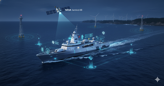
Eyes in the Sky: NASA’s Sentinel-6B Mission
One of the most exciting developments in recent months comes from space. NASA, in partnership with NOAA (National Oceanic and Atmospheric Administration) and the European Space Agency (ESA), is preparing to launch the Sentinel-6B satellite, part of the Jason Continuity of Service (Jason-CS) mission.
This satellite isn’t just another weather satellite; it’s designed with advanced radar altimetry that will collect precise measurements of sea level, wave height, and wind speed from orbit. Its predecessor, Sentinel-6 Michael Freilich, set the standard, and now Sentinel-6B is poised to take that legacy to the next level.
Why It Matters:
- Better Forecasting: With high-resolution radar data, ocean prediction models can be fine-tuned. This helps ships, both commercial and military, avoid dangerous conditions before they become life-threatening.
- Tracking Climate Change: Long-term, satellite-based sea level data is vital for understanding how climate change is impacting coastal areas.
- Enhanced Navigation: Real-time radar altimetry supports precise route planning, helping vessels steer clear of rough waters and navigate more efficiently.
This fusion of space technology and marine radar navigation reflects a growing trend: integrating satellite-based systems directly into everyday maritime operations.
NOAA’s High-Frequency Marine Radar Network
While satellite technology offers a bird’s-eye view, NOAA’s High-Frequency (HF) radar network keeps close watch on what’s happening along the U.S. coastline, minute by minute.
Operated through the U.S. Integrated Ocean Observing System (IOOS), this network is composed of marine radar stations positioned along thousands of miles of shoreline. These systems track surface currents in real time, a critical function for a range of maritime activities.
Why It’s Crucial:
- Search and Rescue: When someone goes overboard or a vessel is lost, the U.S. Coast Guard relies on HF radar data to track currents and predict drift patterns.
- Environmental Protection: HF radar helps in modelling the movement of oil spills or other hazardous materials, aiding in faster, more accurate containment.
- Ecosystem Research: Scientists use the data to study pollution dispersion, fish migration, and changing marine ecosystems.
Standout Benefits:
- Wide-Area Coverage: These marine radar systems can monitor huge ocean areas far beyond the range of traditional shipboard radar.
- Instant Data Access: Real-time updates make HF radar a key asset during emergencies or fast-changing weather conditions.
NOAA’s continued investment in coastal radar reflects a broader strategy: creating a smarter, data-driven ocean observing system to support safety, research, and sustainability.
Offshore Wind Turbines and Radar Interference
As the U.S. shifts rapidly toward renewable energy, especially offshore wind farms, a new problem has surfaced, one that could complicate marine radar systems significantly.
A recent Government Accountability Office (GAO) report has brought attention to how wind turbines can interfere with marine radar signals. This interference poses challenges not just for civilian vessels, but for national security and search-and-rescue missions as well.
Key Issues Identified:
- Ghost Targets: The spinning blades of turbines reflect radar signals, creating false targets, or “ghosts”, on radar displays.
- Signal Disruption: Small vessels, especially fishing boats or recreational craft, may become harder to detect near large wind farms.
- Blocked Line of Sight: Dense clusters of turbines can physically obstruct radar beams, reducing overall detection range.
Implications:
- Defence Readiness: Military radar systems used for coastal surveillance or naval operations may suffer reduced effectiveness.
- Commercial Safety: With false echoes and blind spots, vessel collisions become a more significant risk.
- Regulatory Challenges: These issues are now prompting agencies to reassess policies governing the placement and approval of offshore wind projects.
The takeaway? As we move toward greener energy, we must also ensure it doesn’t compromise maritime safety and security. New regulations and marine radar-compatible turbine designs may be necessary to balance these priorities.
DHS and the Next Generation of Maritime Surveillance
In another major step toward modernising marine radar capabilities, the Department of Homeland Security (DHS) recently released its Maritime Surveillance Technologies Market Survey Report through the National Urban Security Technology Laboratory (NUSTL).
This comprehensive study examines how radar systems are being used by federal, state, and local agencies for:
- Border and coastal security
- Port surveillance
- Maritime emergency response
- Maritime domain awareness (tracking everything happening on and near U.S. waters)
Key Takeaways from the Report:
- Tech Trends: There’s growing interest in solid-state radar and phased-array systems, which offer greater reliability and accuracy.
- Tactical Needs: Agencies are calling for systems that are portable, weather-resistant, and capable of spotting fast, low-profile threats, like small boats used in smuggling or piracy.
- Vendor Insights: The report includes real-world performance reviews of commercial radar products, providing a roadmap for procurement and upgrades.
DHS’s survey not only serves as a strategic planning tool, but it also signals an era where the lines between defence tech, disaster response, and commercial maritime safety are increasingly blurred.
Looking Forward: AI, IoT, and the Smart Radar Revolution
Radar technology is entering the digital age, and the next leap forward involves the integration of Artificial Intelligence (AI), Machine Learning, and the Internet of Things (IoT).
In this new frontier, radar systems aren’t just passive sensors; they’re intelligent decision-makers.
Future Possibilities:
- Automated Threat Detection: AI can sift through radar data to identify suspicious behaviours, like a vessel lingering too long near a port or deviating from a standard shipping lane.
- Predictive Navigation: Machine learning models, fed by real-time radar data, can anticipate changes in weather or sea currents with greater accuracy.
- Smart Ports: IoT-enabled radar systems can sync with other sensors, streamlining everything from cargo logistics to security sweeps.
U.S. government agencies and research institutions are increasingly investing in these technologies. The goal? To build radar networks that don’t just detect, they adapt, learn, and respond in real time.
Conclusion: A New Era in Maritime Awareness
Marine radar is entering a transformative era, evolving from a traditional navigation aid into a critical component of a highly connected, intelligent maritime network. No longer confined to shipboard use, today’s radar systems are part of a broader ecosystem that includes satellites like NASA’s Sentinel-6B, NOAA’s high-frequency coastal radars, and advanced surveillance tools deployed by the Department of Homeland Security.
These technologies are being enhanced with artificial intelligence, machine learning, and Internet of Things (IoT) connectivity, enabling smarter, faster decision-making in real time. Together, they provide a layered approach to maritime awareness, from monitoring sea level rise to tracking vessel movements and supporting emergency response.
However, this progress brings new challenges, such as radar interference from offshore wind farms and increased demands from growing maritime traffic. Addressing these issues requires collaboration between technology developers, policymakers, and maritime operators.
Looking ahead, radar will play a pivotal role in ensuring maritime safety, environmental monitoring, and national security. As oceans become more complex and crowded, radar will not just detect and warn, it will anticipate, analyse, and adapt. In this new era, marine radar is no longer just a navigational tool; it’s a strategic partner in navigating the future.